Thursday, September 30, 2010

Genoa: Birthplace of Columbus?

Had a reasonably decent night's sleep in my room at the Hotel Cristoforo Colombo the first couple of days, probably due to total exhaustion from the full day of travel on September 7.

My hotel room turned out as advertised in Lonely Planet: Italy. It was very nice but moderately priced (three-star), lacking in some of the amenities available at more expensive hotels (like wi-fi in the rooms, although they did have Internet access in the lobby) but providing many of the basics needed by most people. For me, it was perfect.

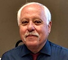
The best feature of the hotel -- in addition to my hosts, Libero and Patrizia Sterlocchi (above) -- was the rooftop terrace where the sunsets were stunning over medieval Genoa.

Breakfast was served every morning on the terrace (left, behind the yellow building), which saved me many euros, and the fare included eggs, ham and salami, pastries and bread, fruit cocktail and, as you might expect, my choice of coffee.

The hotel received its name from the birthplace of the legendary explorer (right), which was but a mere frisbee toss from the front door. Some question whether Columbus was born in Genoa or the nearby island of Corsica, but most believe he was a native Genovese.

"In 1492, Columbus sailed the ocean blue," or so the expression goes. The conventional wisdom is that Genoa's native son "discovered" America.

Of course, the "native Americans" were mistakenly identified by Columbus as "Indians" (India is where he thought he had landed; instead he landed on San Salvador in the Carribean). These indigenous peoples had supposedly migrated over a land bridge from Asia to Alaska and down the coastline to the Americas.

Then, there's Eric the Red and his boy Leif Ericsson, the Vikings who discovered Iceland and Greenland, respectively, prior to the initial voyage of Columbus to the "New World."

As an aside, I flew over Greenland on my way to Frankfurt; I can tell you first hand that there is nothing "green" about Greenland, even during summer in the Northern Hemisphere.

Regardless, the birthplace of Columbus, as witnessed by the steady flow of tour buses (above) rolling by my hotel on Via Porta Soprana, is a popular tourist attraction. The columnar structure (below) was originally the cloistered garden of a nearby monastery where monks and nuns would pray and tend their crops. In the 1930s, Mussolini initiated a restoration of Genoa and had the garden converted to a stock yard for horses and mules.

Just one of a multitude of reasons the Genovese loathed "Il Duce."

Wednesday, September 29, 2010

A Bowl Of Spaghetti Piled High

That's the visual image as described in The Lonely Planet: Italy; the city has virtually no flat land, much like Seattle or San Francisco. Established before the time of Christ, Genoa was an important Roman port that has been inhabited by virtually every possible invader, including Charlemagne, Napolean and -- more recently -- the Nazis.

To its credit, the Genoa was the first northern city to rise against the Nazi occupation and shake off the yolk of Mussolini and Hitler, liberating itelf before the arrival of Allied troops. I remember my Gramma (http://gonzopublicrelations.blogspot.com/2010/06/mia-nonna.html) explaining the end of "Il Duce," Benito Mussolini, the fascist dictator who ruled Italy for a generation. They shot him, and his lover, and strung them up upside down in a piazza in Milano.

Clinging to hillsides the most striking aspect of the city is the architecture. The large commercial structures are works of art and even the residential buildings -- painted bright red, orange and yellow with green shutters -- are charmingly beautiful.

The heart of medieval Genoa, which features dark, almost cavelike laneways and oddly angled blind alleys, is primarily residential, with commercial concerns occupying the ground floor of most buildings.

The city streets are rife with shops and bars, and the medieval old town features a maze of "carrugi," or dark pedestrian alleys (left) that can feel a bit confining and claustrophobic -- a complete contrast to the wide open "piazzas" or town squares.

The building on the right of the narrow alley here is my hotel; my room was on the third floor facing the alley. The walkway is less than five feet across.

The Piazza De Ferrari (below) is the centerpiece of Genoa's main square, which is encircle by magnificent buildings, Among the buildings are the Art Nouveau Palazzo della Borsa (behind the fountain on the left), which once housed the country's stock exchange.

My hosts at the Hotel Colombo -- who had a basic understanding of English -- asked me why my family had left Italy. I explained that (as my Grandmother related to me in a 1975 interview) the year was 1912, and war was in the air.

World War I (known at that time as "The Great War") turned out to be bloody and exhausting for the Italians, who lost 600,000 men in the conflict. The war economy produced a small concentration of powerful industrial barons while the civilian populace lived in poverty. The atmosphere was ripe for a demagogue (see "Il Duce," above).

Back then, my Grandmother emphasized that many young Italian men were looking to do the "23-skidoo" to America -- and many did, including my grandfather and my great-uncle.

The American slang phrase "23-skidoo" was popularized during the early 20th century, first appearing before "The Great War."

The phrase refers to leaving quickly, being forced to leave quickly by someone else, or taking advantage of a rare and/or timely opportunity to leave: in other words, "getting out while the getting is good."

The exact origin of the phrase is uncertain.

While my grandfather arrived in the U.S. in 1904, my grandmother emigrated in 1912 (at age 19), along with her mother, Mary, brother Paul (16) and sister Eva (14). Talk about the adventure of a lifetime! None ever returned to Italy, even to visit.

Needless to say, emigrating to America turned out to be one of the best moves of their lives. The shot below was probably the same view they had leaving Genoa Harbor nearly 100 years ago.


Tuesday, September 28, 2010

Saluti, Italia!

Departed Eugene on Tuesday afternoon, September 7 for a quick flight to San Francisco. A short layover in SF almost caused me to miss my flight to Europe, but I quickly settled in for the brutal 12-hour slog to Frankfurt, Germany.

Based on my experience flying to Korea last year, I knew I wasn't going to be able to sleep much on this long flight -- regardless of the time of day -- so I whiled away the hours reading "Cactus Eaters" by Dan White and watching Iron Man 2 at least twice.

With a short layover in Frankfurt, I boarded a two-hour Lufthansa flight to Milan, the largest city and a center of commerce for Northern Italy. The last part of my journey -- to Genoa (photos above of the city skyline and port) -- would be an adventure.

Standing at a bus stop for Genoa outside for well over an hour, a kindly taxi driver informed me that the busses had stopped running to Genoa for the day, and that a taxi would be too expensive. He suggested the motor coach from Milano Malpensa airport to the Milano Centrale train station. Milano Malpensa is maddening: no one but me spoke English, so I had to rely on my trusty Rick Steves' Italian Phrasebook. It came in handy.

Once I found the right bus, I felt a little more comfortable, but the hour was now getting late; it was almost 9 p.m. local time when I reached Milano Centrale trail station, and I was having a difficult time both finding the correct train and a restroom.

Eventually finding both, I settled into my berth on the train for the two-hour trip to Genoa, the capital of the province of Liguria on the Mediterranean Sea. Arriving close to midnight at the train station in Genoa, it was a short taxi ride to my hotel -- the Cristoforo Colombo, a charming, family-owned facility (above).

My hotel was located in the heart of Old (read: medieval) Genoa, near the birthplace of the famous explorer (above), who reportedly discovered America.

I had reached my destination after traveling for 24 hours. I adjourned to a neighboring bar -- the Cafe Barbarossa (below) -- for several beers before turning in.

Monday, September 27, 2010

Icicle Ridge, 8/20-23: Denouement

What can I say, except for this was another backpacking expedition for the ages, as I'm sure Kelly will agree.

First the learnings: bring trekking poles. Having a third, or even fourth, leg comes in handy. The steadying influence of a trekking pole would have likely averted my fall on Day 1. Next, bring rain (and in this case, snow) gear -- even in August. Turns out foul can occur almost anytime when you're at elevation.

Kelly was chagrined, and rightfully so, at my lack of rain gear. He was quite appreciative, however, that I packed in coffee and vodka, and that I was pretty handy at finding the trail when we lost it.

Next the high points: Having good company along on a trip like this is essential. Kelly and I have been doing this sort of thing together for 30-plus years now, and it never gets old.

Saw some of the most beautiful backcountry on the planet. The spots that were particularly impressive were Carter Lake (with Icicle Ridge in the background, top) and Upper Doelle Lake (bottom).

As they say in Italian, our sojourn along Icicle Ridge was "bellissimo."


Sunday, September 26, 2010

Icicle Ridge, Day 4: The Sun Also Rises

That night, I suddenly awoke -- having recovered from my shivering -- at Carter Lake (above). My tent seemed to be illuminated, and no longer flapping violently in the breeze. "It couldn't be morning already," I thought, glancing at my iPhone. It was 3 a.m.

Curious, I stumbled out of my tent and saw the reason why: the storm had vanished and a bright full moon drenched the entire basin around Carter Lake with light. This was very good news indeed; it meant summer would return at daybreak.

We had now abandoned the idea of making it to Leavenworth; it was too far for the amount of time we had left. Kelly had to catch a flight to Anchorage in a couple of days. Me? I was "smellin' the barn" -- and looking forward to arriving at Owl Farm.

That morning, we enjoyed a couple of cups of coffee thanks to my French press and basked in the increasingly warm sun, mitigating the cold from the night before.

We dallied a bit while breaking down our camp because the solar gain felt so good on our cold, shivering yet stiff bodies. Then -- once we found the trail, which took a little while -- we sauntered down Painter Creek toward U.S. Highway 2.

Climbing the pass between Painter Creek and Hatchery Creek, we witnessed stunning views of Big Jim (below), the high point along the Icicle Ridge. Big Jim was named for James J. Hill, the railroad magnate who built the Burlington Northern Railroad from Minneapolis to Seattle back in the late 19th century. Hill -- known as "The Empire Builder" -- was synonymus with the other big dogs of that era: Rockefeller, Carnegie and Vanderbilt.

Our only problem now was transportation. My vehicle was parked at Stevens Pass; Kelly's truck was in Leavenworth, our original destination. Thank God for cell phones. I called my buddy Roger Wallace and he agreed to meet us at the trailhead. More good news: we encountered another hiker by the name of Julia who would be heading toward Stevens Pass on her way back to Seattle.

At the trailhead Roger had both Coke and beer ready for the weary hikers. Now, I like beer just as much as the next person (maybe more), but I asked for the Coke. From there, Roger drove Kelly down to Leavenworth and Julia transported me to Stevens Pass.

Owl Farm was beckoning, and I would heed its call.


Saturday, September 25, 2010

Icicle Ridge, Day 3: A Hard Rain's A-Gonna Fall

An "upper level disturbance" moved into the North Cascades late on Day 2 (you can see the clouds rolling in on Snowgrass Mountain in the background behind Lake Mary, above), and it started raining in the backcountry. Little did we know what was to come.

That morning, while Kelly slept, I checked out the nearby "Wallowa toilet." Wallowa toilets are basically unhoused pit facilities placed in strategic locations (read: near some campsites) in the wilderness. As a former wilderness ranger, I have -- as you might expect -- seen most of the Wallowa toilets on the Lake Wenatchee District.

Some have spectacular views. My favorite is at Lake Sally Ann on the Pacific Crest Trail, where you can meditate on Mt. Rainier and Mt. Stuart while on the pot.

On the right is our wilderness ranger crew -- (from left, clockwise) Kelly Tjaden, Martha Witt, John Mitchell and Heather Murphy -- installing a new Wallowa toilet in Spider Meadow on the Phelps Creek Trail back in 1979.

In any event, back to Day 3, which started out wet; it would only get worse. As we trekked through Mary Pass (behind Lake Mary, below), it began to hail. By the time we arrived at Ladies Pass, it started to snow -- in August. Of course, we were at 7,000 feet above sea level.

This is where I came to understand the meaning of the term: "the mountains make their own weather." The clouds funneled up toward Ladies Pass at an incredible rate of speed, blasting us with wind and pelting us with hail, snow and rain -- seemingly all at the same time.

Descending into upper Index Creek, the foul weather abated temporarily, but as we climbed toward Carter Lake, I cried "uncle." We stopped at Carter Lake, even though our goal for the day had been Lake Augusta. We were both cold.

We set up camp, cooked dinner, had some cider with vodka and called it a night as a light snowfall continued until dark.


Friday, September 24, 2010

Icicle Ridge, Day 2: The Mischievous Marmot

The sub-title to this post could be called "Chasing Vallindaklopf." Helmut Vallindaklopf is one of Kelly's many pseudonyms and aliases, which tend to keep the authorities at bay.

Knowing that Kelly was a late sleeper, I arose early from my camp at Middle Chain Lake and -- feeling remarkably chipper considering how much pain I was in the day before -- packed my camp and headed up the trail toward the pass to Upper Doelle Lake (above).

Reaching the pass at sunrise, I was rewarded with stunning views of Glacier Peak to the north and Mt. Hinman to the south, and to Upper Doelle Lake (with Bulls Tooth in the background below). Spotting Kelly's bright yellow tent, I signaled my arrival as he enjoyed breakfast while sunning on a large boulder.

Continuing on, we both knew the next stretch of the Icicle Ridge Trail would be tricky. On our map, the trail is marked as "not maintained." That turned out to be an overstatement. We lost the trail a number of times on this day.

After scouring the area around Lower Doelle Lake for awhile, we found what looked like the start of the trail to Frosty Pass, thanks to a couple of hikers who had come from that direction the day before. Unfortunately, they had gotten lost and had given up hope of finding Frosty Pass, returning to Lower Doelle Lake. Not a good sign.

Undaunted -- and perhaps overly confident of our backcountry skills because of our experience as USFS wilderness rangers -- we continued on. Below Lower Doelle Lake, a meadow unfolded with a blanket of wildflowers (above, with Kelly ready to break into a chorus of "The hills are alive, with the sound of music"), including Western Anemone and Giant Red Paintbrush.

The Western Wood Anemone (right), one of my favorite mountain wildflowers, is a hairy plant with finely divided leaves.

The flower is common at altitude on mountain slopes and meadows from British Columbia to the Sierra Nevada, and east to northeastern Oregon and western Montana. Also called Mountain Pasque Flower, the "Pasque" refers to Easter, blooming time of other species.

The Giant Red Paintbrush (left), also called Indian Paintbrush (or perhaps "Native American Paintbrush"), is common in mountain meadows, thickets and forest openings throughout the west.

Most Indian Paintbrush are partial parasites on other plants, their roots establishing connections with roots of other species. As a result, they are difficult to transplant or grow by seed.

From here, the trail became increasingly scarce, and at times, non-existent. I can definitely see how our friends at Lower Doelle Lake gave up. However, we were not to be denied, and after bushwhacking for a spell using a map and compass, we felt we were close.

"Just watch," I told Kelly, "we'll probably stumble onto the trail." Almost as soon as they words left my mouth, we found the clearly marked trail to Frosty Pass.

Arriving at Lake Mary for the night, we encountered a fellow traveler, who -- lacking sufficient campsites in the area, offered to share his considerable space. Lake Mary is where we encountered "Max the Mischievous Marmot" (below).

Marmots -- called "whistling pigs" by 19th century miners and trappers due to the high-pitched whistles they use to communicate -- are wilderness rodents that look like beavers but without the tail. Instead, they have very long claws for burrowing tunnels where the hibernate during the long winters in the backcountry.

Now, I have never encountered such an audacious marmot. Most are very shy; I have never been lucky enough to get a decent picture. Not Max. While setting up camp, Max raided our neighbor's camp; he had taken a day hike to Ladies Pass. Max attacked our friend's gear with gusto. He was maybe 10 yards away, fussing with his gear.

Naturally, we chased him (could be a her, though, which is why we dubbed the rodent as the adrogynous "Max"), but the critter was relentless. "Watch this," I warned Kelly, as I charged the beast. I was surprised at Max's fleetness of foot. The critter had the speed of a young Cocker Spaniel. Eventually, Max gave up.

After dinner, it started raining; we retired at the end of a long day.