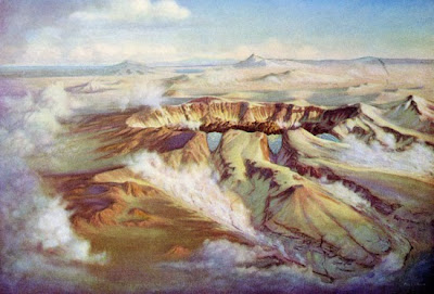
Millennia before the establishment of Crater Lake National Park -- and long before the existence of a lake,
for that matter -- there was a mountain. And what a mountain it was.
More than 400,000 years ago, Mt. Mazama began its building
process with cracks in the Earth’s crust, signaling the rise of a great new stratovolcano in southern Oregon. In time, a vast magma chamber supplied much
of the raw material for the building of Mt. Mazama.
Increasingly, violent surges from below piled volumes of
molten rock, ash and pumice on the surface, according to noted geologist Howel
Williams, a University of California-Berkeley professor who wrote the definitive tome of the region. Eventually, periods of cooling and hardening alternated with episodes of eruption.
“After more than a million years, Mt. Mazama had risen to a
height of almost 12,000 feet, towering far above its neighbors,” Williams
wrote. “In the whole length of the Cascade Range, there were few volcanoes that
rivaled it in size.”
For months, volcanic ash and dust storms enveloped the peak
and blackened the sun. The people of the marshes knew the mountain only by
sound and the trembling Earth at their feet.
Finally, the pace of events quickened, according to
geologists. Then, without warning, Mt. Mazama released a giant, billowing cloud
of black smoke -- punctuated with bursts of lightning -- high into the
atmosphere. Avalanches of hot ash sped down every mountain valley, incinerating
everything in its path. Lethal gas fumes engulfed the native villages in the
marshes.
As the cataclysmic activity grew in strength, the winds
veered toward the northeast and carried smoke and ash as far away as Montana, Alberta and Saskatchewan. The next time the people of the marsh were able to gaze
toward the mountain -- to their surprise and astonishment -- the top half of the
mountain had vanished. More than 5,000 feet of mountain summit had virtually
disappeared.
Today,
geologists concur that the summit of Mt. Mazama collapsed within itself when
the pool of magma drained or was expelled as ash, creating a huge cavity
inside the mountain. In short, the mountain could no longer support its own
weight.


1 comment:
Good show that.
Post a Comment